Viewing the World in a New Way
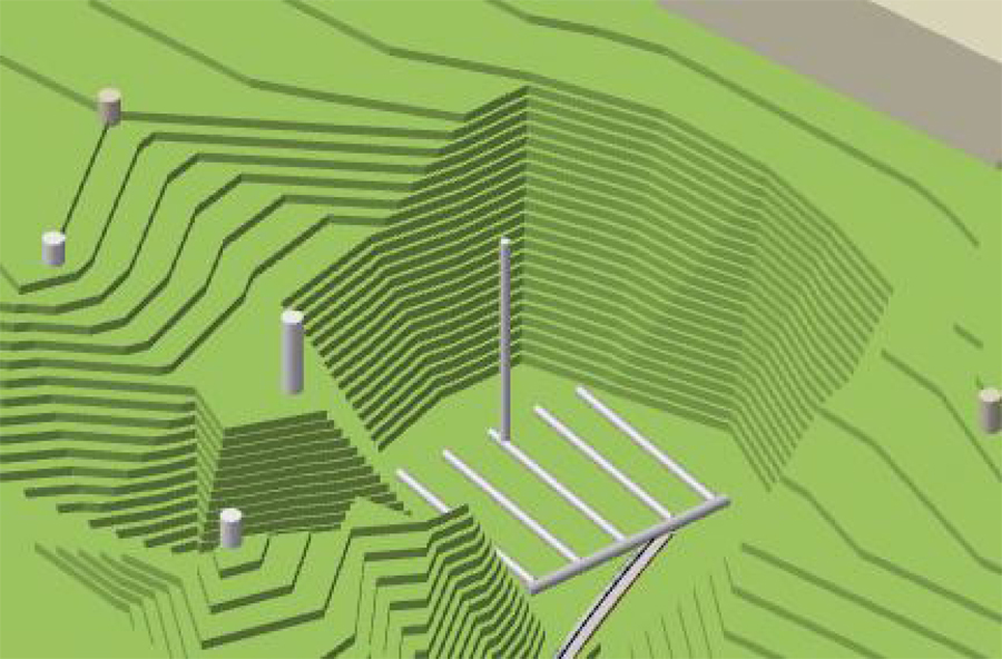
Digital Terrain Modeling
Two-dimensional maps and drawings have been the staple of environmental and engineering work for decades, whether the hard copy paper variety or mapping in a digital environment. And for many projects, this kind of mapping meets the need. There are, however, some circumstances in which being able to get below the surface and see in three dimensions would be advantageous. For solving these kinds of problems, digital terrain modeling provides a powerful tool to look for clues that might go undiscovered in the two-dimensional world.
In the past, digital terrain models have been expensive propositions, used for things like showing what 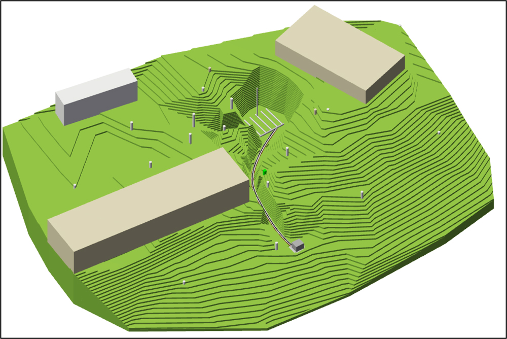 a finished building might look like, or allowing for a virtual walk through a home. Seldom has this technology been applied to modest sized environmental and engineering projects.
At Northwest Geoscience, we have developed a methodology that has proven invaluable when too many answers remained unanswered. We’ve used it to get a handle on a groundwater flow direction that varied dramatically from what it looked like on a flat plane. We were able to see how much real damage had been done to a property as a result of badly managed grading on an adjacent property; We were able to show in good detail what a finished remediation system would look like when it was installed, and determine the combination of factors that were creating excessive moisture in a residential back yard and mold problems in the basement of the house.
 In each case, the outcome was a better understanding of the problems. Only then was possible to create solutions that really worked. In the cases where regulation was involved, regulatory managers gained the ability to see in greater detail, allowing them to make more confident decisions. This allowed projects to move along more quickly, saving money that might have been spent on additional assessment.
If you have a problem in which there are just too many “maybes”, consider taking a look at it in three dimensions. The cost is reasonable, and the results may make the difference in solving the problem and allowing the project to get back on track.